A New Zealand company is using technology similar to Google’s street view to map trees, and scan them for vulnerabilities more accurately, in Southland’s Gore.
New Zealand company Treetech has teamed up with Singaporean business Greehill to roll out the technology, which creates a 360-degree view of the rural district’s tallest residents.
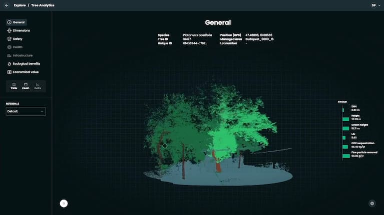
While the car travels at precisely 39km/h, four million lasers and six cameras scan and snap pictures of trees along each side of the street.
It then used that data to identify vulnerabilities in the trees to prevent accidents, and find where more canopy coverage was needed.
Treetech spokesperson Jak Harris told 1News the technology was “quite a game changer”.
“We can capture up to 8000 trees in a day. It’s not only faster, it’s way more accurate… and you get a huge amount more information,” he said.
The setup also used artificial intelligence to identify while driving what species each tree was, and other useful details such as dimensions. It could even simulate a tree’s strength in high-winds.
Harris said “all that information is much more accurate than what you’d get with a traditional arborist walking around and looking from the ground”.
Gore District Council’s park and recreation manager Keith McRobie said “we want to go from a survey that was done on a spreadsheet to latest technology”.
Gore was the first place in the country to have the modern technological survey completed — with Invercargill and Auckland councils also signed up.
The device, described as an MRI scanner for trees, was big overseas.

Greehill’s András Bogár-Szabó was visiting from Hungary to help with the rollout in New Zealand, and has completed a number of scans already.
“We [have] already scanned the whole [of] Marseille in France, which took almost six weeks to finish up.”
He said all of Prague in the Czech Republic and Singapore had been mapped, and there were “really huge towns in North America, which are longer and quite big projects”.
For comparison, Gore could be scanned in just one day.
“A little bit more of a simpler project,” Bogár-Szabó said.
But there was room for further development, in particular, when it came to identifying some of this country’s deep-rooted tree issues, such as kauri dieback.
“It doesn’t get quite that specific with actual diseases, but it would flag very early on that there is dieback in that canopy,” Harris said.
Gore’s council has noticed a difference in results compared to previous surveys.

McRobie said around 22,200 trees were surveyed manually the last time they did it.
“The information we’re going to get out of this is going to be a whole lot better… it’s actually cheaper and it’s probably 10 times better in terms of the value to us,” he said.
He said he believed it would lead to more informed decision-making.
“It gives you the justification that that tree is actually in really good shape and, you know, it needs a bit of love and care.”


